Tranquil Bluff Trail: Mackinac Island’s Longest Hike
Most people who step off the ferry at Mackinac Island spend their day on Main Street, on a carriage tour, or pedaling the shoreline road. Very few of them ever walk the Tranquil Bluff Trail, even though it runs for miles along the island’s eastern cliffs and offers some of the finest water views anywhere in the Straits of Mackinac. The Mackinac Island Tourism Bureau says plainly that not many visitors have hiked it, and that is a big part of its charm. If you want a quiet forest, a long stretch of Lake Huron below you, and almost nobody else on the path, this is the hike to plan your day around. Here is what the trail is really like and how to walk it well.
Where the Tranquil Bluff Trail Starts and Ends
The trail follows the high ground along the eastern edge of the island, which means it links two places most visitors already know by name. It begins near Arch Rock on the southeast side and runs north through the woods toward the British Landing area on the far shore. Because it traces the bluff line instead of the road, you spend the whole walk inside the forest with the lake off to one side. That single fact changes the feel of the day, because you are never far from the water and yet you rarely see another person. Knowing both ends of the trail before you set out makes the rest of the planning simple.
Finding the trailhead at Arch Rock
Arch Rock is the easiest landmark on the island to aim for, and it stands nearly 150 feet above the water on the east shore. From the Arch Rock area, use the current park map and posted trail signs to locate Tranquil Bluff Trail before heading north into the forest. The sign is modest and easy to walk right past while you are busy photographing the arch, so slow down and look for it. If you are coming up from town, the Botanical Trail and Leslie Avenue both feed into this same corner of the island, and our guide to Arch Rock and the Milliken Nature Center covers the approach in more detail.
Where you come out on the north end
As you continue north, the route reaches the quieter part of the island near British Landing. From there, you can connect with M-185 or an interior road for the return, but your total distance will depend on the route you choose. The British Landing Nature Trail begins behind the seasonal nature center and loops past Friendship’s Altar. Services and opening dates can change, so carry what you need and check the current visitor guide before setting out. If you would rather head home along the water, our list of stops on the 8.2-mile bike loop shows what you will pass on the way.
What the Trail Is Actually Like Underfoot
This is where honest expectations matter, because the Tranquil Bluff Trail is not a paved stroll. Mackinac State Historic Parks rates it moderate and describes it as a winding, tree-covered pathway with several steeper slopes to climb. The Mackinac Island Tourism Bureau goes further and calls it the island’s longest and most challenging trail, rugged in places and close to the cliff’s edge. Both descriptions are fair. The surface is dirt and tree root, it rises and falls far more than you would guess on an island this small, and a few short pitches will have you breathing hard before the next view opens up.
The first stretch is the hardest
Hikers consistently report that the section closest to Arch Rock is the toughest part of the whole route, with steep little climbs and tight turns stacked close together. The farther north you walk, the gentler the ground becomes, until the final portion feels almost leisurely by comparison. That shapes how you should plan your morning. Starting at Arch Rock gets the hard work out of the way early and lets you coast the rest of the way to the north shore. Walking it in the opposite direction saves the climbs for the end, which is a good deal less fun on tired legs, so most people find the Arch Rock start the better choice.
How long it really takes
Published mileage and time estimates vary because hikers use different access paths and return routes. Mackinac State Historic Parks estimates about ninety minutes for Tranquil Bluff Trail itself. Allow additional time for the approach from town, photographs, side trails, rest stops, and your chosen route back. Check a current park map before leaving so you can calculate the full distance for your exact plan.
What You Will See Along the Eastern Bluffs
The reward for all that climbing is a long, uninterrupted view of Lake Huron. For most of the walk the water sits far below on your right while a dense hardwood forest rises on your left, and the two trade places in your attention as the trail bends. On clear days you can pick out Bois Blanc Island and watch freighters tracking slowly through the Straits. The light shifts constantly as the canopy opens and closes overhead, which is one reason photographers who know the island keep returning to this particular path, which shows you a very different island from the one you see on Main Street.
Side trips worth the detour
Several short trails break off the main route and lead to features most visitors never find. Eagle Point Cave sits back in the forest off the bluff, and the Lime Kiln and Winnebago trails near Arch Rock open onto traces of the island’s old lime-burning industry. Farther north, the Murray and Soldier’s Garden trails wander through quiet woods on the same side of the island. Each detour adds distance and navigation time, but it can turn a straightforward hike into an afternoon of small discoveries. Watch the junction signs carefully, because they are easy to miss in midsummer when the leaves are full and the undergrowth is high.
Birds, quiet, and the forest itself
The trail earns its name, and the soundtrack is a big part of the reason. Park staff recommend walking in the early hours, when chickadees and warblers are busiest and you may hear a loon calling from the open water below. Deer move quietly through the understory, and wildflowers line the path in spring. Because the bluff carries the trail well above the road and away from carriage traffic, the loudest thing you will hear for long stretches is your own footsteps on the leaf litter. That kind of stillness is genuinely rare on an island that welcomes so many day visitors.
What to Bring and When to Go
A little preparation turns this from a hard walk into a lovely one. The park specifically recommends bug spray and notes that hiking shoes are a major plus because of the slopes, and both suggestions are worth taking seriously. There is no water, no shelter, and no snack stand along the bluff itself, so whatever you carry out of town is what you have until you reach the north shore. Do not rely only on a phone for navigation; carry a current park map as a backup. Our guides to trail maps and navigation and the best shoes for island walking go deeper on both points.
The best time of day and season
Early morning is the clear winner on this trail. The forest is cool, the birds are loud, the light coming off the lake is at its best, and you will almost certainly have the bluff to yourself. Late spring brings wildflowers and comfortable temperatures, summer gives you the fullest canopy along with the heaviest bug pressure, and autumn turns the whole eastern side of the island gold and red. Fall is the local favorite for good reason, though the daylight is shorter and the footing can be slick under wet leaves. Whatever month you pick, start earlier in the day than you think you need to.
Safety and Common Sense on the Bluff
The trail runs close to the edge in places and the drop to the water below is a real one, so this is not the hike for racing ahead or for letting small children run loose. Stay on the marked path, keep well back from any lip where the ground looks undercut, and take the steeper descents slowly, especially after rain. Tell someone at your hotel roughly where you are headed and when you expect to be back, because coverage is patchy and the trail is quiet enough that you may not pass another hiker for a while. Carry water, wear something you do not mind getting dusty, and turn back if the weather changes on you. Handled with a little care, it is a safe and deeply satisfying walk.
Conclusion
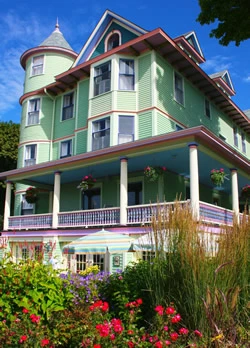
A comfortable room and a quiet porch make a welcome finish after a long trail day. Inn on Mackinac sits on Main Street at the quieter edge of town, with access to routes leading toward Arch Rock and the eastern side of the island. If a peaceful morning above Lake Huron sounds like your kind of trip, explore rooms and availability at Inn on Mackinac and leave enough time to enjoy the trail without rushing.
Category: Mackinac Island